Land Clearing and Tree Cutting
Aerial documentation gives property owners, contractors and project managers a clear view of large tree cutting and land-clearing work—without relying only on ground-level photographs that may miss access routes, surrounding structures and the full limits of the work area.
A Clear Record of a Large Tree Project
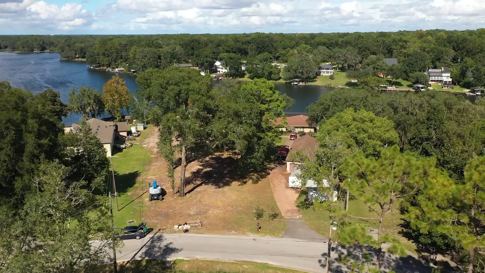
This flight documented a property during a substantial tree-cutting and land-clearing project. From the air, a single image can show the relationship between the active work area, standing trees, equipment access, neighboring improvements, road frontage and the nearby shoreline. That wider context is difficult to capture from the ground.
The imagery creates a time-stamped visual reference that can be shared with a property owner, contractor, insurer, project manager or other stakeholder. It can help everyone review what was accessible and visible on the day of the flight, compare progress between visits and maintain a more complete project record.
Before-and-After Context
Repeatable aerial viewpoints make it easier to compare vegetation, cleared areas and overall site conditions as work progresses.
Safer Site Overview
A drone can document broad areas, tall trees and difficult sightlines while reducing unnecessary walking through active or uneven work zones.
Shareable Documentation
Current photographs and video give remote owners and project teams a concise visual update without requiring every stakeholder to visit the property.
What Aerial Land-Clearing Documentation Can Show
- The apparent extent of cleared and remaining vegetation
- Large trees, canopy coverage and nearby structures
- Equipment access routes and road frontage
- Shorelines, neighboring properties and surrounding site context
- General progress between scheduled documentation flights
- Current visual conditions for client and contractor updates
Drone imagery is visual documentation—not a boundary survey, arborist evaluation, engineering inspection or certification of completed work. When measurements, property lines or professional opinions are required, the appropriate licensed professional should review the project.
Need Current Aerial Documentation?
mdpAIR provides FAA Part 107 aerial photography and project-documentation services for land clearing, tree work, construction progress, property inspections and remote site reviews throughout Daytona Beach, Port Orange, Ormond Beach, New Smyrna Beach and surrounding Central Florida communities.
View more mdpAIR projects or explore our aerial inspection services.